Cemeteries Moved to Crown Hill
As the city and county continued to grow, some of the small family cemeteries became neglected and even abandoned. Fortunately, in more recent years there have been efforts to preserve them elsewhere. Two such pioneer cemeteries were saved by moving them to Crown Hill’s Pioneer Cemetery.
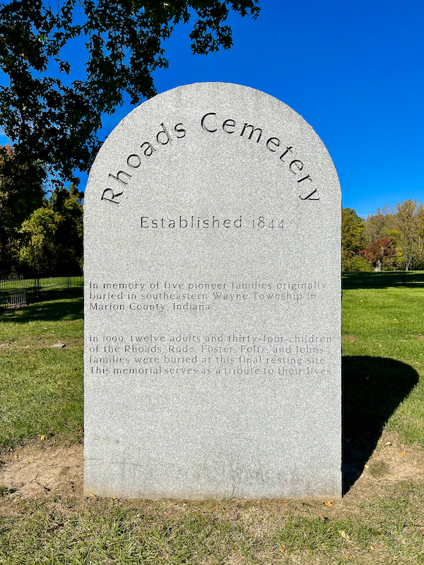
 The Rhoads Cemetery had been established in southeastern Wayne Township in 1844 when James Rhoads died. Over the years 12 adults and 34 children from the Rhoads and four other families were buried there. But the need for expansion in the Park Fletcher Industrial Park in 1999 resulted in them being reburied at Crown Hill. A large monument tells the story and on its back shows the configuration of burials and identifies them only by sex and as an adult, a child, or an infant. An identical monument describing the Greenlawn reburials was erected at the same time.
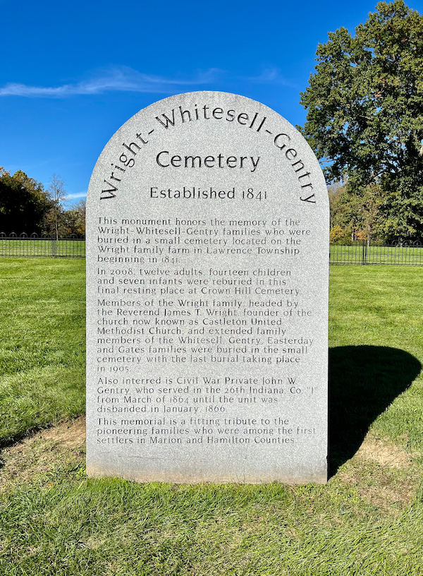
The Wright-Whitesell-Gentry Cemetery was established on the Wright Family farm when Charles Wright was buried there in 1841. Eventually, as the city grew and developed, this little pioneer cemetery came to be nestled in the curve of the exit ramp from I-69 to westbound I-465 in Castleton. In 2008, a team of forensic anthropologists, working with the Indiana Department of Natural Resources, hand-dug each grave, removed the caskets, catalogued what they found in them, including items of clothing. They then hand-dug the new graves in our Pioneer Cemetery exactly as they had been located in Castleton. They reburied 12 adults, 14 children, and seven infants, and re-set their original monuments. A dedication ceremony of their new home in the Pioneer Cemetery included Wright-Whitesell-Gentry descendants and those who had so carefully and meticulously seen to their reburials.
The next time you’re at Crown Hill, pay a visit to the Pioneer Cemetery. To stand inside the wrought iron fence so that you see only the Wright-Whitesell-Gentry Cemetery monuments and the prairie and trees beyond is to be transported back in time.
You can locate the Pioneer Cemetery on our Visitor’s Guide & Map, or plug this GPS into your map app: (39.8272328, -86.1792271).